Vulnerable navigation and timing better protected. New toolkit helps identify and reduce risks
The use of satellites for navigation and timing is so normal that we often do not realize how vulnerable this technology actually is. Whether it concerns navigation in your car, coordinating transport or accurately determining the time for financial transactions: Global Navigation Satellite Systems (GNSS) are an indispensable link in our daily lives. But what happens when these systems are disrupted? A new website with toolkit helps to understand and reduce these risks.
GNSS: Important, but vulnerable
GNSS include satellite navigation systems such as the American GPS and the European Galileo. These systems send signals to Earth, which receivers use to accurately determine their position and/or time. But these signals are vulnerable to disruption, such as jamming and spoofing.
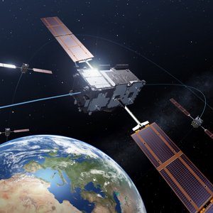
Vier Galileo satellieten in orbit around Earth © ESA – P. Carril
With jamming, GNSS signals are blocked by strong interference signals, which means that, for example, a ship at sea or a truck can no longer determine its location. Spoofing goes one step further. A false signal is sent that resembles the real signal. This can cause a recipient to think he is in a different place than where he really is. The consequences of this can be disastrous: a drone that deviates from its route, a financial transaction that takes place at the wrong time, or even a ship that docks at the wrong location.
According to Alexandra Zevenbergen of CGI, one of the developers of the toolkit, many organizations are not aware of the risks. “Many companies think that GNSS are always reliable, but that is a misconception. It is important that users become aware of the risks and take proactive measures to mitigate them.”
Hans Scholten, contracter on behalf of the Ministry of IenW, added: ‘The 2023 Satellite Data Outage Vulnerability Inventory (IKUS II) revealed that many organisations are not yet sufficiently aware of the risks of using satellite navigation. While organisations are themselves responsible for the reliability of their systems, the toolkit was created to help them do so.’
GNSS Resilience Assessment: help with a growing problem
The ‘GNSS Resilience Assessment’ toolkit does not solve security issues, but offers users a way to test how well their systems are protected against disruptions and provides advice on security measures. It was created on behalf of the Ministry of Infrastructure and Watermanagement by the EGNSS Centre of Excellence, together with CGI, NLR and S[&]T. The development of the toolkit was supported by the Netherlands Space Office (NSO) and ESA NAVISP.
The toolkit allows users to perform a self-scan to see where their systems are vulnerable. It also provides strategies to reduce risks, such as using alternative systems or techniques to amplify or secure GNSS signals.

Alexandra Zevenbergen explains: ‘The toolkit helps users understand where their systems are vulnerable and provides concrete recommendations for measures that can increase the resilience of systems to disruptions. Examples include applying redundancy in systems, such as combining GNSS with other sensors, using more robust signals or deploying sensing technologies to recognise early disruptions.'
Strength in accessibility
Kees Oude Lenferink of the Netherlands Space Office (NSO) stresses the importance of the toolkit for users who depend on GNSS: ‘The strength of this toolkit lies in its simplicity and accessibility. You don't need to be an expert to get started with it. It enables organisations to assess their own risks and take preventive measures. In a world where we are increasingly dependent on GNSS, it is essential that we protect our systems properly. This toolkit provides a valuable tool to do just that.’
Find out more
Want to know more about the toolkit: GNSS Resilience Assessment or perform the self-scan? Then visit the EGNSS Centre of Excellence's PNT portal.