Improving food security by satellite data and market development
In 2050, there will be 9 billion people to feed. How can we ensure this? This is one of the major challenges the world is facing the next decades. Two years ago, and commissioned by the Dutch ministry of Foreign Affairs, Netherlands Space Office (NSO) started the programme Geodata for Agriculture and Water (G4AW), in order to support initiatives to improve food security in vulnerable countries by application of satellite data.
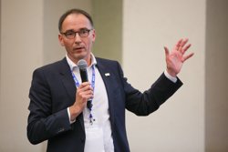
The investment already pays off with some striking success stories of G4AW-supported projects, recently published by the international initiative to promote the use of open data to improve food security, GODAN. NSO’s project manager of G4AW, Dr Ruud Grim, will share his views and experiences with 750 participants, from students to ministers, on the GODAN Summit 2016 in New York this week. The magic word is ‘market development’, according to Grim.
Q: Would you say open data directly stimulates market development for sustainable food production for the world?
A: Yes. In the G4AW programme, the participation of businesses like seed production companies, insurance and banking companies, nutrient producers and telecom providers is really important. This is the next step towards a sustainable provision and use of these services to food producers. Open data is provided for free, but what a customer, like a smallholder farmer or pastoralist, actually needs is some specific information or advice. Service delivery costs money, the operational cost must come from sales and/or other financial revenues, from other clients and/or stakeholders. In other words, a business model and financial plan behind the services is essential.
Q: What kind of challenges do you see in relation to open data?
A: Continuity and access to satellite data has been an major barrier in the past. Nowadays, US and Europe have set up satellite programs to ensure continuity in the provision of satellite earth observation data. This will stimulate businesses to set up services, and in time, customers to engage with service deliveries utilizing satellite data. All G4AW projects develop and operate services that use data from the European Copernicus Sentinel satellites. The challenge now is to cooperate along the information chain to deliver the information that is actually needed by food producers.
 Q: What are the success stories of G4AW so far?
A: The first four G4AW projects started in 2014 and are now actually testing their services in practice. One of them is a project called GIACIS (Geodata for Innovative Agricultural Credit Insurance Schemes) in Ethiopia. After the partnership presented their goals, strategy and most importantly the business plan, the project was immediately adopted and supported by the government. Together with the government the GIACIS partnership aims to reach 15 million farmers in 5 years.
As we speak, 200 000 farmers are already partaking in the test phase of the development of a rural banking infrastructure. Insurance is added as a service for the farmers that now have loans to run their businesses. Should the crop fail, the farmers get new seeds and fertilizers for the next crop, thanks to this insurance. In the future, this should lead to a sustainable financial situation for the farmers, enabling them to save money instead of having to borrow. This way, open data supported by a solid business plan can enhance sustainable economic growth and self-reliance.